Thursday, May 14, 2009

Ballard Park Field Trip

Perhaps you're a visitor that wants to get in a little exercise while you're here, or the kids just need to get somewhere where they can run around and make noise. Or maybe you're a local, like myself, that wants to meet some friends for lunch but you don't want to sit inside. Ballard Park is the perfect spot.

The 10-acre Ballard Park is one of the City of Melbourne's Community Parks. It is located off US #1, between the Melbourne and Eau Gallie Causeways - we'll tell you how to get there in the Just the Facts section at the end of this post. It's right on the Indian River Lagoon and the Eau Gallie River, and that means it gets great breezes - I've been there on some pretty hot days, but those breezes keep it just about perfect.

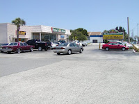
Ballard Park has a little bit of everything - little pavilions, big pavilions, a fenced children's playground, basketball, racquetball, and lighted tennis courts, a boat ramp, shaded benches for ruminating, really clean bathrooms, and best of all - plenty of room for everybody! Dogs are allowed, but they must be on leashes (and pick up after them, of course). The slideshow in the right-hand column will give you an idea of the amenities.
What I like about Ballard Park is that there are folks coming and going, but it doesn't seem busy or crowded. This is a great place to unwind, read a book, talk with a friend, have a picnic.
Just the Facts
Ballard Park
"BIG PICTURE" LOCATION: Central Brevard, Mainland, Melbourne
WHEN TO GO: Seven days a week, 7 a.m. until 9 p.m.


HOW TO GET THERE: From US #l, turn east on Thomas Barbour Drive. Follow Thomas Barbour Drive for 0.3 mile to the Park entrance. (Thomas Barbour Drive is about 3 miles north of Hwy 192.) Luckily, there is a very handy sign at the intersection of US #l and Thomas Barbour Drive - you'll not only know the time and temperature, you'll easily see where to turn!
If you need to head south when you leave the Park, don't try to cut across US #l. Instead, turn left on Coral Drive (the street right before US #l) and follow it to Ballard Drive, where there's a stoplight. (Google map)
WHERE TO PARK: There is plenty of parking available.
WHAT TO WEAR: This is Florida - wear sunscreen and a hat unless you're going to be under a pavilion the entire time. Otherwise, wear whatever suits your planned activity.
PHYSICAL CONSTRAINTS: There are no constraints to enjoying some aspect of the Park that I can think of. The bathrooms are very nice!


HOW LONG TO STAY: Stay as long as you wish (as long as you leave by 9 P.M).

WHAT TO DO: Bike, boat, play racquetball or basketball, play tennis, let the kids play on the playground while you sit at a nice covered pavilion, have a picnic, read a book, watch the boats in the river, walk the dog, or do nothing at all!
BRING MONEY? No money needed

WHERE TO EAT AFTERWARDS: At the stoplight at US #l and Ballard Drive (to the south of Thomas Barbour), you'll find Nature's Market, a health food store with takeout food. For the other end of the spectrum, try Del's Tasty Freeze, to the south of the stoplight on the west side of the street.

HOW TO HELP: As always, don't litter, and don't speed through the neighborhood or the park.
REFERENCE LINKS:

Tuesday, May 12, 2009

Fanned out fish nests

During my field trip to Viera Wetlands (March 31 post), Charlie Corbeil pointed out "fish nests" in the water near the banks of the ponds. These were circular indentations in the sand, about a foot in diameter, and if you were patient, a fish would swim in and hover over the nest/bed. I tried several times to take a decent photo of a fish and a nest, but between my old camera and the reflective water (not to mention my amateur photography skills), I did not succeed.

Friend Wayne was at the Wetlands and Click Ponds the other day and sent some great photos of fanned out fish nests that have been revealed by the low water levels (no rain in 26 days, darn it, but a good photo op). I did some research, and here's what I learned. It seems that the nests are "fanned out" by male fish. The female fish then spawns (lays her eggs in the nest). The male returns, fertilizes the eggs, drives away the female, and protects the nest until the eggs hatch and the fry are about an inch long. Apparently, this is common with such fish as bass and bream. I didn't find much scholarly information on this one - most of the data centered around fishing hints and the psychology of catching pregnant fish (one fellow compared a spawning bass to his sister-in-law). Wayne noted that when he was a boy in North Florida, Usually we could smell the beds when fish were laying eggs--they had a strong, fishy smell. Sometimes we would fish the beds, but usually the fish at the center of each bed would either ignore the bait or try to chase it away.

Wayne also sent along an interesting blog link (see Links below) with a good post about a pond with fish beds. The author was more successful than I in getting a couple of photos with fish swimming over the nest. (If any of you have a good picture of a fish over his nest, I'd be delighted if you'd share it with us.)

I'm worried about what will happen to the eggs in those nests now above water - perhaps the water reclamation folks will put enough water in to cover them again. (Will that help? Fishermen - I can use some help here.) Meanwhile, many thanks to Wayne for his photos and data.

Links:
Fish and Frog - Turtle and Blog

Friday, May 8, 2009

Canaveral Lock, Avocet Lagoon, and Rodney S. Ketcham Park Field Trip

Note: The Canaveral Locks at Port Canaveral will be closed for maintenance from December 27, 2010 to February 24, 2011 and again from March 15 to April 22, 2011 for installation of a new manatee protection system.

The Canaveral Lock is a little tough to find, but it's well worth the effort. The Lock is located at Port Canaveral, between the Port's West Turning Basin and the Banana River. It is used by pleasure craft to get between the ocean and the river, but it is also used after every shuttle launch in the transport of the shuttle booster rockets that fall into the ocean after liftoff and must be returned to Cape Canaveral Air Force Station for rework and reuse. The Lock was dedicated in 1965 and is maintained by the US. Army Corps of Engineers. (This photo by Wayne Matchett. Click on photos to enlarge.)

For visitors to the Space Coast, understand there is a City of Cape Canaveral and then there is Port Canaveral. Port Canaveral is the second busiest cruise port in the world. To get to the Lock, if you come up A1A from the south, you'll travel through the city first, then through Port Canaveral, an adventure in itself! Port Canaveral is a growing, bustling, busy area, so be watchful - everybody seems to know where they are going and they are ALL in a hurry. We'll give you the details of how to get there in the Just the Facts section at the end of this post.

As you might expect, given the location, the Lock is a magnet for fish and birds. But it's also a nice place to just sit and watch the world go by at a safe distance, so to speak. The day I was there marked the arrival of the world's largest cruise ship, Royal Caribbean’s Freedom of the Seas, on its maiden voyage, and there were various events all day to celebrate its arrival. Personally, I enjoyed viewing it from the peace and quiet of the Lock! You'll see the ship in the background of some of the photos, and there are more from friend Wayne in the slideshow.


As you're driving to the Lock, you'll pass Rodney S. Ketcham Park, located at the boat launch area. Rodney S. Ketcham was a much-beloved Southern gentleman, long-time Brevard County community leader, and Port Authority Board Commissioner from 1996 until his death in 2008. The park is a constant reminder of his contributions to the County and to the gracious growth of the Port.
Once you get to the Lock, you'll find Visitor Parking, then it's just a short walk to the fenced entrance. You can sit at the observation area overlooking the mechanics of the Lock (and be observed by the Pelicans sitting opposite, observing YOU), or wander down to the picnic table pavilions.


Trash can indicator and the path to Avocet Lagoon
But if you don't mind getting your feet a little muddy, here are directions to Avocet Lagoon, a true hidden treasure. (My thanks to Harvey, who drove in at the same time I did. Harvey is a photographer and frequent Lock visitor, and he provided me with the directions to Avocet.) Across the entrance road from the wooden garbage container closest to the gate, you'll find a path through the shrubs. Take this path,
and suddenly you're at Avocet Lagoon! The day I was there, it was full of all sorts of birds - my photos are not excellent, but you'll get the general idea. Harvey told me that Jim Meyers of the Space Coast Audubon Society (SCAS) has worked for several years to get an observation tower constructed that will overlook Avocet Lagoon, and it appears the tower may actually be built soon. Heads up - you are likely to get your shoes muddy at the Lagoon, and they'll smell bad, but it's worth it!

Just the Facts
Rodney S. Ketcham Park, Canaveral Lock, and Avocet Lagoon
"BIG PICTURE" LOCATION: Central Brevard, Beachside, Port Canaveral
WHEN TO GO: Canaveral Lock and Avocet Lagoon are accessible 7:00 a.m. to 9:00 p.m., seven days a week. Rodney Ketcham Park is accessible 24/7.


HOW TO GET THERE: I took A1A north through Cape Canaveral and turned onto North Atlantic Avenue at the big curve. Follow North Atlantic Avenue to the Port. At George King Boulevard, turn left and follow it to Dave Nisbet Drive. Look for this sign right before the intersection of Dave Nisbet Drive and Mullet Road. Turn onto Mullet road and follow it faithfully. You'll go past Rodney S. Ketcham Park and a yacht club. You'll go under a bridge and loop around, and eventually you'll wind up at the parking lot for the Lock. It's only a couple of miles from the Dave Nisbet and Mullet Road intersection. (The interactive map in Reference Links below gives directions from I-95.) Google Map (Google marker shows beginning of Lock - keep going!)
WHERE TO PARK: Plenty of visitor parking at Canaveral Lock and Rodney Ketcham Park
WHAT TO WEAR: Wear something cool, and wear a hat and sunscreen if you plan to stay long (the water amplifies the sun's effects). Wear comfortable shoes that you don't mind getting muddy if you go to Avocet Lagoon.
PHYSICAL CONSTRAINTS: At the Lock, the road from Visitor Parking to the Observation Area is paved. The path to Avocet Lagoon is short, but downhill and rough. There are portolets at the Lock (referred to as Latrines, reflecting the Army Corps of Engineers terminology). I'd say Rodney Ketcham Park is fully accessible, but I didn't see any portolets.


Canaveral Lock Pavilion and Ketcham Park Pavilion

HOW LONG TO STAY: Stay as long as the spirit moves you! There are covered picnic tables and trash cans at both the Lock and Rodney Ketcham Park, so either would be good spots for a picnic.

WHAT TO DO: Wander around, take photos, or just relax. Pets on a leash are allowed (pick up after them, please). Fishing is not allowed at the Lock, but you can fish near Rodney Ketcham Park.


BRING MONEY? No - this is all free
WHERE TO EAT AFTERWARDS: The answer to this question will require yet another field trip to Port Canaveral proper - there are several eating spots, but I have not eaten at any of them yet. If you follow the direction arrow to The Cove, I believe you'll find a collection of places to dine. Follow the link to Places Around Florida - Port Canaveral for some good information. If you have a recommendation, please feel free to leave it in a comment.
HOW TO HELP: As always, don't litter and don't annoy the critters. A reader left a pertinent comment on the Viera Wetlands post - don't let children run around yelling - it scares the birds and bothers other visitors.

Avocet (the bird)

A LITTLE BIT EXTRA: Friend Wayne visited Canaveral Lock and Avocet Lagoon and got lots of good photos, so they're included in a slideshow (right-hand column of this blog). He took some lovely bird photos, and a cute three-series of a pelican catching a fish, eating the fish, and burping after eating the fish. He and his wife, Julie, viewed the departure of Freedom of the Seas from a location near Jetty park, and Wayne shared photos of that also. One photo in particular is spectactular!

Saturday, April 25, 2009

River Lakes Conservation Area, Moccasin Island Tract Field Trip

If you’ve followed our previous posts, you’ve driven through the Viera Wetlands and perhaps strolled around Click Ponds - fun, convenient, and nearly instant gratification. The third leg of this adventure will make you work a little harder. Moccasin Island Tract is about 4 miles past Viera Wetlands and Click Ponds. You’ll drive west along a washboard road to reach a parking area, and from there, you will either walk, bicycle, or ride your horse along one of two trails. Your eventual destination is the St. Johns River and Lake Winder.

First, some history. Sometimes we tend to take our rivers and lakes for granted. Fortunately, organizations like the St. Johns River Water Management District take a more proactive approach. The District owns about half a million acres, and 98% of it is open to the public.

The River Lakes Conservation Area is District land. It comprises 36,156 acres in Brevard and Osceola counties and includes 14,000 acres the District bought from The Viera Company several years ago. The Moccasin Island Tract was part of that acquisition. The St. Johns River flows north, and as it makes its way through Brevard County, it forms lakes on its path, including Lake Hell ‘n’ Blazes, Sawgrass Lake, Lake Washington, Lake Poinsett, and our eventual destination, Lake Winder. (As I was researching this post, I got totally enamored of the river, nearly forgetting that my goal was to tell you about Moccasin Island Tract. There are references in the Links section that will take you to more river information.)


The How To Get There section of this post gives detailed instructions on how to get on the 3.5 mile road that will take you to the Moccasin Island Tract parking pasture. Driving down the washboard road, you’re riding alongside Duda Ranch property, and you’ll notice signs that tell you not to stop on the road. Pay attention. If you stop, somebody in a Duda Company truck will probably come along and ask you to keep moving. Also, be advised that offroad vehicles (including motorcycles and all-terrain or track vehicles) are not allowed on the property.


North Trail Gate, South Trail Gate, and Information Kiosk


Two trails lead from the parking lot. The north trail is 2.5 miles long and ends in a picnic shelter overlooking Lake Winder. The south trail is 2.6 miles long and ends in a 2-mile loop trail and a marshy area with a shelter. According to friend Wayne, an avid bicyclist, the trails are hard-packed short grass, basically tracks made by various authorized vehicles. A wide-tire bike is best, but a narrow-tire bike should have no trouble--might take more energy pedaling.

The River Lakes Conservation Area is home to variety of birds and critters, including gopher tortoise, Florida softshell turtles, wood storks, bald eagles, crested caracara, roseate spoonbills, sandhill cranes, white tailed deer, wild hog, and wild turkey. There are rumors of a nest of burrowing owls, but I don’t know anybody that has seen it. When Charlie Corbeil took me on a “recon” trip, we saw this beautiful red rat snake.

As always, many thanks to Wayne Matchett for sharing his biking adventure and photos with us. Click on the photos to enlarge.


Just the Facts
River Lakes Conservation Area
Moccasin Island Tract


"BIG PICTURE" LOCATION: Central Brevard, Mainland, Viera


WHEN TO GO: Seven days a week. The gate opens at 7:00 a.m. and closes at 7:00 p.m. You don’t want to get locked in there. Remember that it is going to be hot, hot, hot on those trails in the summer, so act accordingly.


HOW TO GET THERE: See the map and directions in the Viera Wetlands post (April 4 post). When you see the Road Ends sign, just before the South Central Water Reclamation Facility, make a right turn and then an immediate left turn. This puts you on a limerock road that ends in a parking lot at the River Lakes Conservation Area, Moccasin Island Tract.


WHERE TO PARK: Anywhere in the parking area.

WHAT TO WEAR: As you can tell from the parking pasture photo, this is Florida wild country – wear sturdy shoes, and remember your sunscreen, water, and mosquito repellant. Particularly remember to bring plenty of water – this is no place to get dehydrated.

PHYSICAL CONSTRAINTS: You need to be pretty hale and hardy for this adventure. No portolets, either!


HOW LONG TO STAY: In Wayne’s words: I rode the 2.5-mile north trail, which took about 1 hour out and about 45 min. back. As usual, I poked along taking pictures and checking out the flora and fauna. It was easy going with my wife's off-road bike. I probably got up to 5 mph at times. The point here is not speed. Take your time and smell the cow pies. Speaking of which, at one stop I didn't notice what I was doing and stepped off my bike into a very fresh cow pie.

The south trail is longer – 2.6 miles, then a 2-mile loop through an oak hammock that Wayne says is more interesting and shadier.

WHAT TO DO: Hike, bicycle, or horseback ride through one or both of the trails. At the end of the north trail, there is a picnic shelter overlooking Lake Winder. At the end of the south trail, there is a picnic shelter overlooking the St. Johns river.

BRING MONEY? No, this is FREE!

WHERE TO EAT AFTERWARDS: See the Viera Wetlands post for recommendations, or drive down Wickham Road to the Pineda Causeway. There is a little restaurant called Grecian Garden in the strip shopping center on the corner of Wickham and Pineda Causeway (lots of construction there – be careful) that has good food and great rice pudding.

HOW TO HELP: As always, don’t speed, don’t annoy the cows or the wildlife, and don’t litter. Pay attention to signs that say don’t enter. Don’t stop on the 3.5 mile road driving in, and don’t be late getting out.

NOTE: This area is surrounded by Wildlife Management Areas, so use caution during hunting season. Indeed, you’ll see a sign to that effect at the entrance to the north trail.

REFERENCE LINKS:
St. Johns River Water Management District
St. Johns River History
River Lakes Conservation Area Recreation Guide
River Lakes Conservation Area Management Plan

A LITTLE EXTRA: Thanks to Wayne's photos, there is a Moccasin Island Tract slideshow in the right-hand column of this blog


Near the observation tower on the north trail, a 2.5 mile agricultural dike built in the 1950s is being leveled. This will eventually result in reflooding of about 2,900 acres of marsh, much to the delight of fishermen (it will also serve as a water treatment area). This effort just started, so we’ll keep you updated with progress.


July 2011 update: A reader contacted me to see if dogs were permitted at Moccasin Island Tract. I checked with Charlie Corbeil, and he said dogs on a leash are allowed. Be a little careful - according to a recent story in Florida Today, a fellow picked up a palm frond and was bitten by the pigmy rattler hiding underneath. And of course, take plenty of water for your canine friend as well as for yourself.

Monday, April 13, 2009

Seen at Viera Wetlands and Click Ponds

The Viera Wetland roads were closed for a few days so that County workers could smooth out the potholes, but the weather has been lovely and people have walked the dike roads instead of driving them. Friend Wayne snapped this photo on a recent visit. I like what appears to be a man and a bird having a conversation, although Wayne tells me that's just my over-active imagination kicking in.
Our recent posts have been pretty wordy, so I thought you might enjoy these photos of some of the residents at the Wetlands and nearby Click Ponds.


This is a young Crested Caracara - one of a family in residence this year at the Wetlands. Wayne thought perhaps the parents and sibling had deserted this little fellow, but after a few days of investigation, he located the other family members. The Caracara is the national bird of Mexico, and I've always thought that little black hat and beady-eyed stare had a definite Latin look! Caracaras are frequently seen walking and running on the ground. Or like this one, waiting for somebody to pick him up after basketball practice! (Doesn't he look just like a teenager waiting for Mom? I assume he knows how to roll his eyes and sigh.) Be sure to click to enlarge the photos - they really show this little guy's personality.

You'll frequently see the adult Anhingas drying their wings in the sun - these birds do not come equipped with the standard oil gland that birds use to waterproof their feathers. Anhingas swim mostly below water, sticking just that long neck and head out (earning them the nickname of snake bird), and thus lose a lot of body heat. Cornell ornithologists maintain that the Anhinga basks in the sun primarily to regulate its body temperature, not just to dry its feathers. The male Anhinga is black with beautiful silver patches on its wings. The female has a brown head and neck and no bling (go figure). The above photo shows the Anhinga's sharp, pointed beak that allows it to spear fish.

It's easy to confuse the Cormorant and the Anhinga. They are about the same size - approximately two feet long, with a wingspan of about four feet. The Pelican, Cormorant, and Anhinga are related, and all have four webbed toes (instead of three like other waterbirds). The Cormorant (shown above) has dark brown or black feathers, a hooked bill, and an orange throat pouch. You can see the hooked bill in this photo - that bill feature dictates how it obtains its food. It dives for fish from the water's surface, flips the fish in the air, and swallows it head-first.
(Here's a trick to remember which is which - the Cormorant's bill has a hook, like a C. The Anhinga bill is straight, like the side of an A.)
This is just a small sample of what you might see during your field trip to Viera Wetlands and Click Ponds, so grab your cameras and head on out there!
As always, our thanks to Wayne Matchett for sharing his photos and his expertise. (Be sure to click on the photos to enlarge.)

Saturday, April 11, 2009

Joyous Easter

May the joy and promise of Spring and Easter be yours.
(Photo by Jim Angy)

Saturday, April 4, 2009

Dan Click Ponds Field Trip (Near Viera Wetlands)

Click Ponds, Viera Wetlands (previous post), and River Lakes Conservation Area Moccasin Island Tract (next post) are near each other. You can visit all three in one "recon" trip if you wish.

After Charlie Corbeil and I finished our drive through the Viera Wetlands, we took a side trip to Dan "Click" Ponds (usually just called Click Ponds). These ponds are very near the entrance to the Water Reclamation Facility we told you about in the Viera Wetlands field trip report, and you'll want to include a visit to them in your trip to the Wetlands. (There are no entrance signs, but I've included detailed directions and photos in the Just the Facts section of this post.)
Like the Viera Wetlands, the Click Ponds are a part of the South Central Regional Wastewater System, and likewise serve as home to lots of birds and critters. According to Charlie, they are particularly enticing to birds when the water level is drawn down. As with the Wetlands, you can drive along the berms and take photos from your car, or you can hike or bicycle.
Mostly, I was curious about the name and the history. Jim Angy told me Dan Click was a long-time local birder, so through the wonders of the Internet and the Audubon Society on-line newsletter, I found an email address for Dan and sent him an inquiry. I received a delightful, detailed response that he said I could share with you. In Dan' words: The South Central Regional wastewater system extends from west Cocoa south to Post Road. It was established in the late 1980’s and its centerpiece, the regional treatment plant, was dedicated in August 1990. At that time, the principal means of disposal of the treated effluent was irrigation of the nearby Duda sod fields. The sod watering schedule, dependent on planting cycles and weather, differed greatly from the rate of flow through the plant; this made daily and seasonal effluent storage necessary. That was the original purpose of the ponds.

As the Viera area has grown, the use of reclaimed water for irrigation within the community has replaced the original agricultural application. The function of the ponds remains storage, but the destination of the water is now lawns and landscaping, usually after passing back through the plant or the wetlands. The wetlands system was not part of the original construction; it was added about ten years later when the plant capacity was expanded.

Soon after the ponds were filled – becoming the only open water for miles around – they began to attract lots of birds, particularly migrants and wintering waterfowl. I was the project manager for the South Central regional system, working in the Brevard office of a large engineering firm. Also, as you have noted, I am an active birder. I and others prevailed on the County to allow public access to the pond site. We were successful and the site became very popular, first with the local birding community and gradually with others around the state.
With charming, self-deprecating humor, Dan says that several years ago, his birding friends starting referring to the ponds as Click Ponds, and the name stuck. After he left private engineering work, he worked for Brevard County in Parks and Recreation and then in the Utility Services Department until retiring in 2008. Dan says that sometime around Christmas of 2007, The South Central plant staff, realizing the association between me and the birders’ name for their ponds, took it upon themselves to install the sign along the entrance drive. Little did they know that for years, I have threatened bodily harm to anyone doing so!
For you birders, walkers, hikers, and bikers, Click Ponds are a "hidden jewel." For me, learning about them was an introduction to another Conservation Hero!

Just the Facts
Click Ponds

"BIG PICTURE" LOCATION: Central Brevard, Mainland, Viera
WHEN TO GO: Sunrise to sunset, seven days a week


HOW TO GET THERE: See the map and directions in the Viera Wetlands post. When you see the Road Ends sign, turn right onto the dirt road alongside the power lines. After about 50 feet, turn left onto the dirt Four Mile Road. Go another 50 feet, take the first right, and go through the gate. "Click" on the photos to enlarge (pun intended - sorry). And you thought I was kidding when I said "hidden jewel!"
WHERE TO PARK: There is no parking lot, but you can pull over on the berm.
WHAT TO WEAR: As with the Wetlands, you can take photos from the comfort of your car, but if you wish to experience nature more intimately, wear comfortable shoes and remember your sunscreen, water, and mosquito repellant.
PHYSICAL CONSTRAINTS: Since you can remain in your automobile and take pictures out the car window, there are no real physical constraints. There are no benches for sitting and no portolets.
HOW LONG TO STAY: It only takes about ten minutes to drive around the ponds, but you'll miss a lot if you don't linger and commune with nature a little.
WHAT TO DO: You can drive, walk, or bicycle. Of course, bring your camera.
TAKE MONEY? No, this is FREE!
WHERE TO EAT AFTERWARDS: See the Viera Wetlands post for recommendations.
HOW TO HELP: Don't speed, don't hog the berm road, don't annoy the wildlife, and don't litter.
A LITTLE EXTRA: Dan spoke of the nearby Duda sod field. The Duda Ranch in Brevard County is the parent property for the town of Viera.